Evidence for the pit's ESG report.
An autonomous survey drone that flies the same route on a schedule and measures what an open-pit mine has to report on: dust, slope movement, water, rehabilitation and heat. Built for compliance, not for exploration.
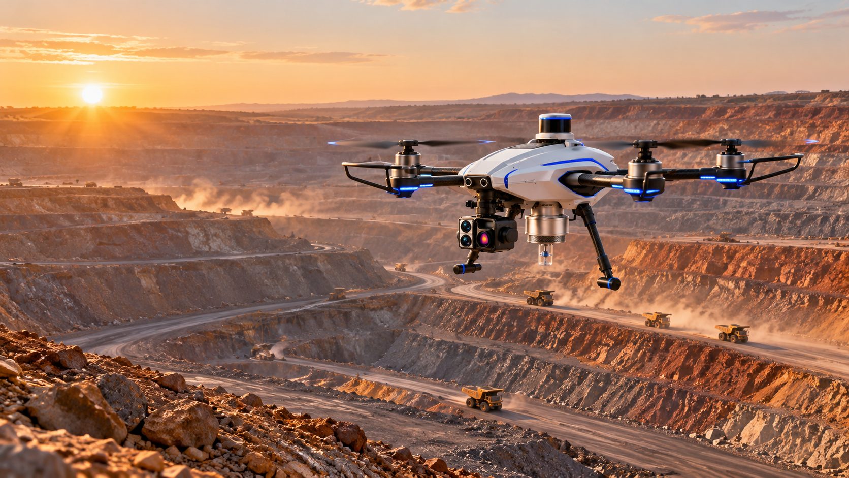
A report is only as good as the survey behind it.
Open-pit operators are asked to show that dust is controlled, walls are stable, water is managed and land is being restored. Walking the pit with instruments is slow and puts people in the highest-risk parts of the site. A drone that repeats one route can measure more often, and keeps people out of harm's way.
It does not look for ore.
This drone is for operating mines that already exist. It does not prospect, map mineral deposits or assess resources. Its job is to produce repeatable, time-stamped evidence about the site's environmental and safety condition.
Six jobs, one flight plan.
Dust and particulates
An air-sampling inlet and particulate sensor read dust along haul roads, active benches and stockpiles, at the heights that matter.
Heat and emissions
A thermal camera flags hot spots such as heating stockpiles and burning material. Gas sensing is planned as an option.
Water and tailings
Repeat visual and LiDAR surveys of ponds, sumps and drainage lines show changes in extent, level and condition.
Land rehabilitation
The same route over restored benches builds a dated record of cover and progress that can be compared survey to survey.
Slope and bench movement
LiDAR change detection compares each survey with the last, so cracks, slumps and creep show up early and without sending people to the wall.
An audit trail
Every flight is geotagged, time-stamped and flown on the same route, so a reviewer can see what was measured, where and when.
Concept stage. Measurements are design targets and will be validated against reference instruments in pilots.
Built around its sensors.
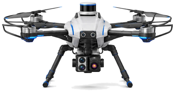
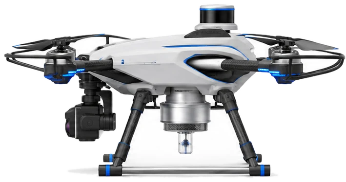
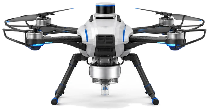
LiDAR dome
Scans pit walls, benches and stockpiles for change detection and volumes.
RGB and thermal camera
Stabilised visual and heat imaging for walls, water, vegetation and hot spots.
Air-sampling pod
Draws in air for dust and particulate readings while the drone flies the route.
Obstacle vision
Forward cameras for avoiding walls, equipment, wires and people.
Guarded rotors
Carbon-fibre arms with propeller guards for flying close to rock faces.
Status lights
Blue arm lights show flight state, readable from across the pit.
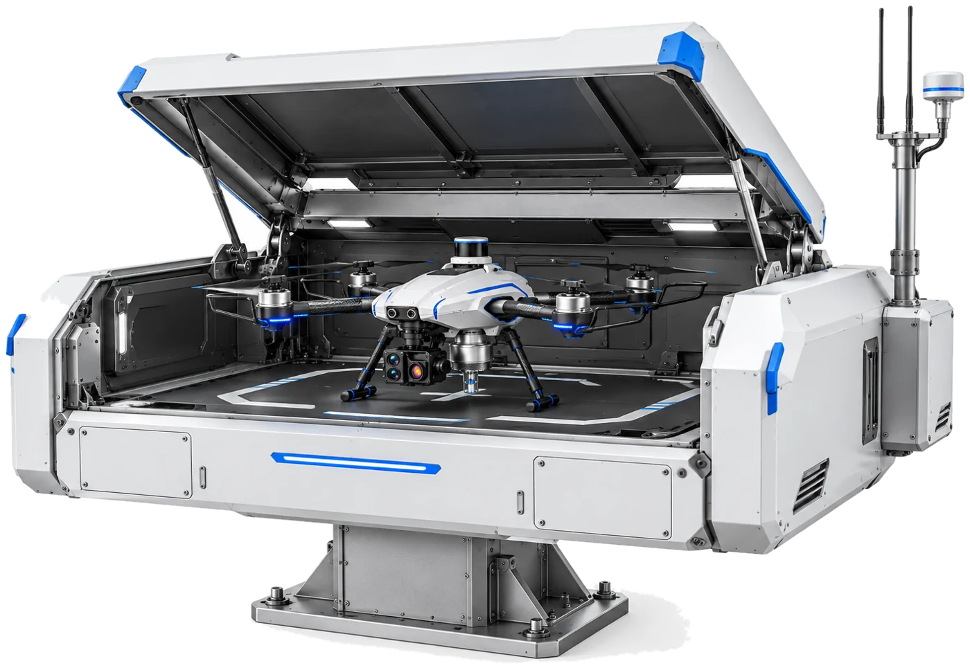
It flies itself and lands itself.
A weatherproof dock keeps the drone sheltered and charged between flights. At the scheduled time the roof opens and the drone flies its route, then returns, lands and uploads the data. No pilot has to be on the bench.
- Roof opens only for a flight
- Charging pad and landing guide
- Antenna mast with satellite positioning
- Data uploaded after every flight
Dock functions are design intent for the first pilot site.
From schedule to evidence.
Set the route
The mine's environment team fixes routes, heights and times once. The drone repeats them.
Measure on the way
LiDAR, cameras and the air sampler record along the whole route.
Against the last survey
Changes in walls, water, dust and cover are marked against earlier flights.
Hand over the record
Dated, geotagged, sealed data that a qualified person can review, sign and attach to a report.
Evidence an auditor can check.
A reading is only useful if someone else can trust it later. Every survey is kept as a record that shows when it was taken, where, by whom and whether anything has changed since.
Every reading is located
Time, position, height and route are stored with every measurement, so a figure can always be traced to a spot on the site.
Nothing is overwritten
Each survey is a new version. Earlier surveys stay, so change over months and years can be shown rather than asserted.
Sealed at the dock
Each data package is given a checksum when the drone lands. A later edit to the data no longer matches it, so it shows.
Volume change over time
Repeat LiDAR surveys of the pit floor, benches, stockpiles and spoil record how much material has moved between surveys. It is a record of activity on site, not a resource estimate.
Progress against the plan
Dated records of restored benches and cover, area by area, set against the closure and rehabilitation commitments the mine has made.
Water and tailings against the rules
Surveys can be set up around the conditions in the mine's environmental permit, water rights and tailings plan, so the record answers the questions a reviewer will ask.
A qualified reviewer signs off
A competent person at the mine reviews a survey and signs it before it goes into a report. The signature stays with the data.
Updated on a schedule
Scheduled flights replace a yearly walk-round with regular surveys, so the record stays current rather than looking back.
Takes the data anywhere
Point clouds, maps, images and readings export in standard formats that other reporting and registry systems can read.
Design intent. Record format and sign-off steps will be agreed with the first pilot site.
A mine is the wrong place for a drone that can be talked into things.
The drone carries the same idea as every Inztinct robot: a fixed layer between the AI and the motors that the AI cannot talk to. It decides where the drone may fly, and it can only make those limits tighter.
Fixed no-fly zones
Blast zones, haul roads and buffers around working equipment are limits the planner cannot cross.
Limits only shrink
A blast notice or a wind warning can shrink the flight area. Nothing can enlarge it.
Go home safely
Low battery, lost link or strong wind sends the drone back to the dock without asking the AI.
Approved routes only
Routes and limits change through signed releases that a person on site approved.
What we claim, and what we do not.
- The drone is designed to repeat a fixed route and record where and when each reading was taken.
- Flight limits sit outside the AI, and context can only tighten them.
- Surveys keep people away from walls and active benches.
- That it replaces regulated monitoring stations or calibrated reference instruments. Sensor readings are validated against them in pilots.
- That it makes a mine compliant. It gathers evidence. The operator and the regulator decide.
- That survey volumes are resource or reserve estimates. They show material moved, and a competent person must still review them.
- That it is flying today. This is a concept with renders, and the first pilot is still to be agreed.
- That it needs no approvals. Flights need the aviation regulator's permissions and the mine's own.
Working with.


Run an open-pit mine? Let's pilot it on one bench.
We are looking for a mine with ESG reporting duties and an environment team willing to test the first surveys with us.